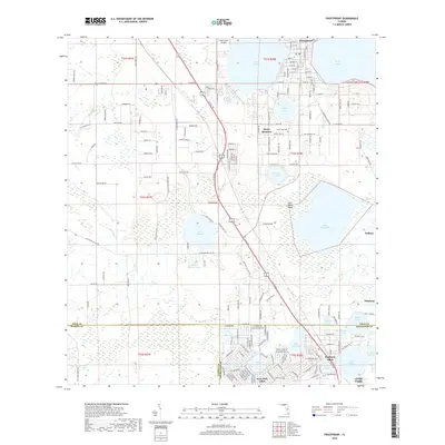
2018 Map of Frostproof
USGS Topo · Published 2018About this map
The Lake Wales Ridge dominates this Central Florida landscape, creating a distinct sandy upland corridor punctuated by dozens of freshwater basins. In the north, Frostproof sits between Lake Clinch and Reedy Lake, serving as a primary hub of settlement. The map reveals the intricate water network of the region, where larger bodies like Lake Livingston and Lake Streety are surrounded by numerous smaller named basins such as Pansy Lake and the Saddle Blanket Lakes.
Find a feature on this map
185 named features on this map. Tap any name to fly to it.
Don’t see what you’re looking for? This feature index may not catch every label — zoom into the map to look around manually.
Map Details
Editions of this 2018 Frostproof Map
This is the sole edition of this map. No revisions or reprints were ever made.
Other maps of this area

1952 · Lake Arbuckle SW
USGS Topo · 1:24,000

1952 · Babson Park
USGS Topo · 1:24,000

1952 · Lake Arbuckle
USGS Topo · 1:24,000

1952 · Lake Weohyakapka
USGS Topo · 1:24,000

1953 · Frostproof
USGS Topo · 1:24,000

1953 · Avon Park
USGS Topo · 1:24,000

1955 · Alturas
USGS Topo · 1:24,000

1956 · Bereah
USGS Topo · 1:24,000

1956 · Griffins Corner
USGS Topo · 1:24,000

1956 · Fort Pierce
USGS Topo · 1:250,000