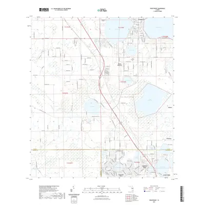
2021 Map of Frostproof
USGS Topo · Published 2021About this map
Frostproof anchors the northern reaches of this central Florida landscape, situated along the Lake Wales Ridge where citrus groves and sandy soils meet an expansive network of freshwater lakes. The settlement pattern reflects the area's agricultural and residential development, from the established streets of Avon Park in the south to smaller clusters like Maxcy Quarters and Neilson. Significant conservation efforts are visible at the Saddle Blanket Scrub Preserve, protecting rare scrub habitat amidst the surrounding land use. Water dominates the geography, with large bodies such as Reedy Lake, Lake Livingston, and Lake Clinch providing natural boundaries for local growth. Historically significant sites like the Silver Lake Cem and the Lake Clinch Airpark indicate the long-standing community infrastructure that supports this portion of the ridge, while watercourses like Old Town Cr and Mill Seat Creek drain the low-lying basins between the elevated sandy ridges.
Find a feature on this map
168 named features on this map. Tap any name to fly to it.
Don’t see what you’re looking for? This feature index may not catch every label — zoom into the map to look around manually.
Map Details
Editions of this 2021 Frostproof Map
This is the sole edition of this map. No revisions or reprints were ever made.
Other maps of this area

1952 · Lake Arbuckle SW
USGS Topo · 1:24,000

1952 · Babson Park
USGS Topo · 1:24,000

1952 · Lake Arbuckle
USGS Topo · 1:24,000

1952 · Lake Weohyakapka
USGS Topo · 1:24,000

1953 · Frostproof
USGS Topo · 1:24,000

1953 · Avon Park
USGS Topo · 1:24,000

1955 · Alturas
USGS Topo · 1:24,000

1956 · Bereah
USGS Topo · 1:24,000

1956 · Griffins Corner
USGS Topo · 1:24,000

1956 · Fort Pierce
USGS Topo · 1:250,000