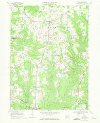
1967 Map of Fryburg
USGS Topo · Published 1971About this map
Oil and gas wells dominate this rural landscape in the late 1960s, appearing as dense clusters of production alongside numerous strip mines. The southern portion of the sheet is defined by significant transportation infrastructure, where the Baltimore and Ohio and Penn Central rail lines converge near Shippenville and Shippenville Station. This intersection marks a transition from the industrial activity of the northern highlands down toward the corridor of Paint Creek.
Find a feature on this map
38 named features on this map. Tap any name to fly to it.
Don’t see what you’re looking for? This feature index may not catch every label — zoom into the map to look around manually.
Map Details
Editions of this 1967 Fryburg Map
4 editions found
Other maps of this area

1906 · Clarion
USGS Topo · 1:62,500

1907 · Clarion
USGS Topo · 1:62,500

1907 · Foxburg
USGS Topo · 1:62,500

1908 · Foxburg
USGS Topo · 1:62,500

1922 · Oil City
USGS Topo · 1:48,000

1922 · Tionesta
USGS Topo · 1:62,500

1924 · Oil City
USGS Topo · 1:62,500

1924 · Tionesta
USGS Topo · 1:62,500

1943 · Oil City
USGS Topo · 1:62,500

1946 · Tionesta
USGS Topo · 1:62,500