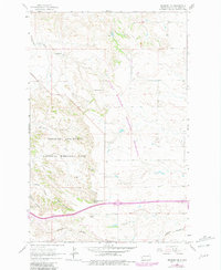
1962 Map of Fryburg NE
USGS Topo · Published 1981About this map
Theodore Roosevelt National Memorial Park dominates the western portion of this landscape, where the deeply carved terrain of Painted Canyon and Cedar Canyon meets the expansive Little Missouri National Grassland. This 1962 survey, later photorevised in 1981, captures the Badlands during a period of transition as the Burlington Northern railroad corridor and local ranching operations defined the area's economic footprint. Scattered across the high plateaus and creek bottoms are family-named landmarks like Lindbo Ranch and Talkington Ranch, which provide evidence of the region's agricultural heritage.
Find a feature on this map
16 named features on this map. Tap any name to fly to it.
Don’t see what you’re looking for? This feature index may not catch every label — zoom into the map to look around manually.
Map Details
Editions of this 1962 Fryburg NE Map
2 editions found
Other maps of this area

1953 · Dickinson
USGS Topo · 1:250,000

1953 · Watford City
USGS Topo · 1:250,000

1957 · Dickinson
USGS Topo · 1:250,000

1957 · Watford City
USGS Topo · 1:250,000

1962 · Tracy Mountain
USGS Topo · 1:24,000

1962 · Fryburg NE
USGS Topo · 1:24,000

1962 · Belfield SW
USGS Topo · 1:24,000

1962 · Fryburg
USGS Topo · 1:24,000

1962 · Fryburg NW
USGS Topo · 1:24,000

1962 · Belfield
USGS Topo · 1:24,000