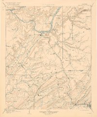
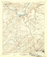
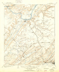
1903 Map of Gadsden
USGS Topo · Published 1920About this map
The Tennessee River snakes through the northern reaches of this Northeast Alabama terrain, defining a landscape of high ridges and river-dependent commerce before the mid-century dams altered the valley. Near Guntersville, multiple ferries and river points like Coal Landing and Lovelace Landing suggest an economy tied to the water, while the interior is dominated by the massive Gunter Mountain and Sand Mountain.
Find a feature on this map
158 named features on this map. Tap any name to fly to it.
Don’t see what you’re looking for? This feature index may not catch every label — zoom into the map to look around manually.
Map Details
Editions of this 1903 Gadsden Map
4 editions found

Other maps of this area

1885 · Gadsden
USGS Topo · 1:125,000

1886 · Stevenson
USGS Topo · 1:125,000

1888 · Cullman
USGS Topo · 1:125,000

1888 · Gadsden
USGS Topo · 1:125,000

1888 · Scottsboro
USGS Topo · 1:125,000

1888 · Huntsville
USGS Topo · 1:125,000

1889 · Springville
USGS Topo · 1:125,000

1889 · Birmingham
USGS Topo · 1:125,000

1892 · Cullman
USGS Topo · 1:125,000

1892 · Birmingham
USGS Topo · 1:125,000