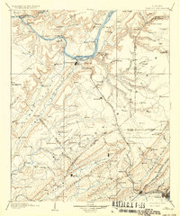
1903 Map of Gadsden
USGS Topo · Published 1936About this map
Gunter Mountain and Lookout Mountain define the high terrain of this landscape, flanking the deep valleys of the Tennessee River and its numerous tributaries. Surveyed in the 1880s, the map illustrates an era of river-based commerce and emerging rail connectivity. Guntersville sits prominently at a bend in the river, served by various crossings such as Ferry and nearby Lovelace Landing. The industrial and agricultural growth of the late 19th century is evident in the presence of the Nashville Chattanooga and St Louis RR and the Alabama Great Southern Railroad, which linked the valley settlements. Regional life centered on small communities like Albertville, Boaz, and Attalla, while the northern reaches show isolated spots like Ft Deposit and Coal Landing along the river banks.
Find a feature on this map
155 named features on this map. Tap any name to fly to it.
Don’t see what you’re looking for? This feature index may not catch every label — zoom into the map to look around manually.
Map Details
Editions of this 1903 Gadsden Map
4 editions found

Other maps of this area

1885 · Gadsden
USGS Topo · 1:125,000

1886 · Stevenson
USGS Topo · 1:125,000

1888 · Cullman
USGS Topo · 1:125,000

1888 · Gadsden
USGS Topo · 1:125,000

1888 · Scottsboro
USGS Topo · 1:125,000

1888 · Huntsville
USGS Topo · 1:125,000

1889 · Springville
USGS Topo · 1:125,000

1889 · Birmingham
USGS Topo · 1:125,000

1892 · Cullman
USGS Topo · 1:125,000

1892 · Birmingham
USGS Topo · 1:125,000