1959 Map of Gadsden West
USGS Topo · Published 1985About this map
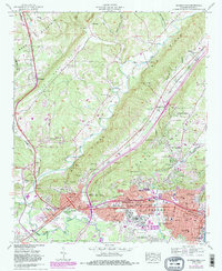
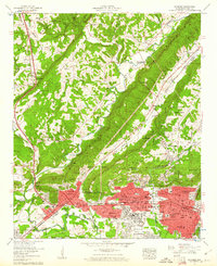
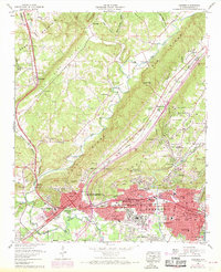
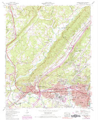
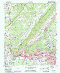
Gadsden and neighboring Attalla serve as the industrial and topographic focal points of this 1959 survey, situated where Lookout Mountain and Sand Mountain meet the Coosa River valley. The map documents a dense network of heavy industry and transportation, including the Southern Railway and Louisville and Nashville RR lines that served the region's manufacturing core. Significant historical infrastructure is visible, such as the coke ovens near Alabama City and the gaging station along Wills Creek.
Find a feature on this map
95 named features on this map. Tap any name to fly to it.
Don’t see what you’re looking for? This feature index may not catch every label — zoom into the map to look around manually.
Map Details
Editions of this 1959 Gadsden West Map
5 editions found
Other maps of this area

1885 · Gadsden
USGS Topo · 1:125,000

1888 · Gadsden
USGS Topo · 1:125,000

1889 · Springville
USGS Topo · 1:125,000

1892 · Springville
USGS Topo · 1:125,000

1892 · Gadsden
USGS Topo · 1:125,000

1893 · Fort Payne
USGS Topo · 1:125,000

1895 · Gadsden
USGS Topo · 1:125,000

1898 · Fort Payne
USGS Topo · 1:125,000

1900 · Fort Payne
USGS Topo · 1:125,000

1900 · Anniston
USGS Topo · 1:125,000