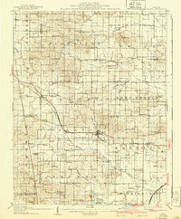
1908 Map of Galatia
USGS Topo · Published 1940About this map
Galatia and Raleigh serve as the primary hubs in this southern Illinois landscape, where the rural character is defined by a dense network of country schools and churches. The survey captures the region as it transitioned into the early 20th century, with the Illinois Central Railroad and the St Louis and San Francisco RR carving paths through the drainage basins of the Middle Fork Saline River and Long Branch.
Find a feature on this map
89 named features on this map. Tap any name to fly to it.
Don’t see what you’re looking for? This feature index may not catch every label — zoom into the map to look around manually.
Map Details
Editions of this 1908 Galatia Map
2 editions found
Other maps of this area

1905 · Eldorado
USGS Topo · 1:62,500

1906 · Eldorado
USGS Topo · 1:62,500

1908 · Galatia
USGS Topo · 1:62,500

1909 · West Frankfort
USGS Topo · 1:62,500

1916 · Equality
USGS Topo · 1:62,500

1925 · Marion
USGS Topo · 1:62,500

1925 · Harrisburg
USGS Topo · 1:62,500

1938 · Galatia
USGS Topo · 1:62,500

1939 · Ina
USGS Topo · 1:62,500

1939 · Harrisburg
USGS Topo · 1:62,500