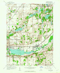
1961 Map of Galesburg
USGS Topo · Published 1962About this map
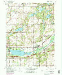
Morrow Lake and the Kalamazoo River dominate the southern landscape of this 1961 revision, where the New York Central railroad tracks run parallel to the water through Galesburg. The presence of the County Infirmary and several family-named burial sites, including Shafter Cem and Barley Cem, provides significant detail for local genealogical research. To the north, the transition from the village of Richland toward Gull Lake is marked by a distinctive glaciated terrain of small kettle lakes and marshes, such as Sherman Lake and Three Lakes. Evidence of ancient habitation is preserved at the Indian Mounds near Rowe Island, while mid-century infrastructure is visible at the Powerplant and Sewage Disposal sites. This survey also documents the Military Reservation on the eastern edge and the recreational footprint of the Ben Johnston Boy Scout Camp.
Find a feature on this map
35 named features on this map. Tap any name to fly to it.
Don’t see what you’re looking for? This feature index may not catch every label — zoom into the map to look around manually.
Map Details
Editions of this 1961 Galesburg Map
5 editions found
Other maps of this area

1916 · Kalamazoo
USGS Topo · 1:62,500

1918 · Kalamazoo
USGS Topo · 1:62,500

1918 · Galesburg
USGS Topo · 1:62,500

1918 · Leonidas
USGS Topo · 1:62,500

1922 · Schoolcraft
USGS Topo · 1:62,500

1943 · Kalamazoo
USGS Topo · 1:62,500

1943 · Schoolcraft
USGS Topo · 1:62,500

1944 · Leonidas
USGS Topo · 1:62,500

1944 · Galesburg
USGS Topo · 1:62,500

1947 · Augusta
USGS Topo · 1:24,000