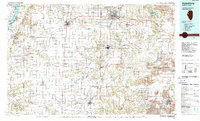
1989 Map of Galesburg
USGS Topo · Published 1989About this map
Galesburg and Monmouth anchor this late-twentieth-century landscape, where the agricultural plains of Western Illinois are carved by a dense network of watercourses and heavy rail lines. The Mississippi River forms the western boundary, its wide channel punctuated by features like Mankins Island and Oquawka Island. To the east, the Spoon River and Cedar Creek wind through a patchwork of townships, including Chestnut, Indian Point, and Salem. This map illustrates a mature industrial and agricultural infrastructure, notably the extensive trackage of the Atchison Topeka and Santa Fe RR and the Burlington Northern RR that funneled goods through the region's transport hubs.
Find a feature on this map
172 named features on this map. Tap any name to fly to it.
Don’t see what you’re looking for? This feature index may not catch every label — zoom into the map to look around manually.
Map Details
Editions of this 1989 Galesburg Map
This is the sole edition of this map. No revisions or reprints were ever made.
Other maps of this area

1912 · Canton
USGS Topo · 1:62,500

1912 · Macomb
USGS Topo · 1:62,500

1913 · Colchester
USGS Topo · 1:62,500

1914 · Macomb
USGS Topo · 1:62,500

1915 · Avon
USGS Topo · 1:62,500

1916 · Good Hope
USGS Topo · 1:62,500

1918 · Vermont
USGS Topo · 1:62,500

1918 · La Harpe
USGS Topo · 1:62,500

1918 · Good Hope
USGS Topo · 1:62,500

1921 · Vermont
USGS Topo · 1:62,500