
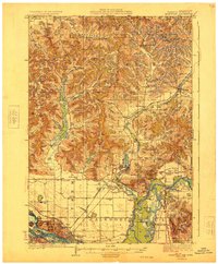
1929 Map of Galesville
USGS Topo · Published 1929About this map
Marinuka Lake and the village of Galesville anchor this 1920s landscape where the driftless region's coulees meet the broad floodplains of the Mississippi River and Black River. The mapping shows a deeply agricultural society organized around numerous rural schools like American Valley Sch and Penny Sch, while prominent landmarks such as Decorah Mound and Decorah Peak rise sharply above the Decorah Prairie. The topographic detail reveals how early settlement patterns followed the natural drainage of the Tamarack Creek valley and the numerous coulees, such as German Coulee and Holcomb Coulee.
Find a feature on this map
94 named features on this map. Tap any name to fly to it.
Don’t see what you’re looking for? This feature index may not catch every label — zoom into the map to look around manually.
Map Details
Editions of this 1929 Galesville Map
2 editions found
Other maps of this area

1926 · North Bend
USGS Topo · 1:62,500

1926 · Whitehall
USGS Topo · 1:62,500

1927 · Blair
USGS Topo · 1:62,500

1927 · La Crosse
USGS Topo · 1:62,500

1929 · Whitehall
USGS Topo · 1:62,500

1929 · Fountain City
USGS Topo · 1:62,500

1929 · North Bend
USGS Topo · 1:62,500

1930 · La Crescent
USGS Topo · 1:62,500

1930 · La Crosse
USGS Topo · 1:62,500

1932 · Gilmanton
USGS Topo · 1:62,500