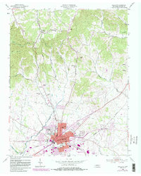
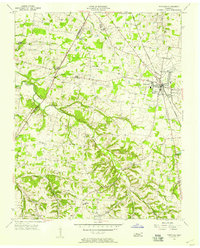
1955 Map of Gallatin
USGS Topo · Published 1983About this map
Gallatin serves as the focal point of this Sumner County landscape, showing the city's expansion near the northern reaches of Old Hickory Lake. The map captures a moment when the Seaboard rail line and local pikes like Dobbins Pike dictated the movement of goods and people through the Tennessee interior. North of the city, the terrain transitions into a series of ridges and hollows, including Poplar Hollow and East Hollow, where smaller settlements like South Tunnel and Graball are situated.
Find a feature on this map
49 named features on this map. Tap any name to fly to it.
Don’t see what you’re looking for? This feature index may not catch every label — zoom into the map to look around manually.
Map Details
Editions of this 1955 Gallatin Map
5 editions found
Other maps of this area

1903 · Nashville
USGS Topo · 1:125,000

1931 · Adolphus
USGS Topo · 1:62,500

1942 · Gallatin
USGS Topo · 1:100,000

1952 · Hendersonville
USGS Topo · 1:24,000

1953 · Cottontown
USGS Topo · 1:24,000

1955 · Bethpage
USGS Topo · 1:24,000

1955 · Laguardo
USGS Topo · 1:24,000

1955 · Hunters Point
USGS Topo · 1:24,000

1955 · Gallatin
USGS Topo · 1:24,000
1956 · Portland
USGS Topo · 1:24,000