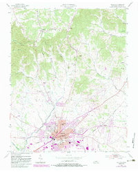
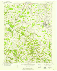
1955 Map of Gallatin
USGS Topo · Published 1983About this map
Gallatin serves as a bustling hub in Sumner County, centered around a dense grid of civic and educational infrastructure including City Hall, the County Health Center, and multiple local schools. The Seaboard railroad corridor anchors the industrial and transport movement through the region, connecting the main town site to outlying settlements like South Tunnel and Graball. To the south, the impact of mid-century infrastructure is evident where the Gallatin Steam Plant Reservation (TVA) meets the waters of Old Hickory Lake.
Find a feature on this map
46 named features on this map. Tap any name to fly to it.
Don’t see what you’re looking for? This feature index may not catch every label — zoom into the map to look around manually.
Map Details
Editions of this 1955 Gallatin Map
5 editions found
Other maps of this area

1903 · Nashville
USGS Topo · 1:125,000

1931 · Adolphus
USGS Topo · 1:62,500

1942 · Gallatin
USGS Topo · 1:100,000

1952 · Hendersonville
USGS Topo · 1:24,000

1953 · Cottontown
USGS Topo · 1:24,000

1955 · Bethpage
USGS Topo · 1:24,000

1955 · Laguardo
USGS Topo · 1:24,000

1955 · Hunters Point
USGS Topo · 1:24,000

1955 · Gallatin
USGS Topo · 1:24,000
1956 · Portland
USGS Topo · 1:24,000