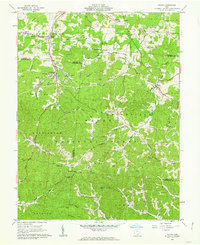
1961 Map of Gallia
USGS Topo · Published 1963About this map
The hills at the border of Jackson, Lawrence, and Gallia counties are deeply defined by the industrial extraction and rural community life documented in the early 1960s. Wayne National Forest covers much of the southern landscape, while the Baltimore and Ohio railroad serves the industrial hubs at Blackfork Junction and Blackfork. The presence of numerous Claypits and a Strip Mine near Brady Creek reflects the era's reliance on the region's mineral wealth, specifically its refractory clays and coal.
Find a feature on this map
80 named features on this map. Tap any name to fly to it.
Don’t see what you’re looking for? This feature index may not catch every label — zoom into the map to look around manually.
Map Details
Editions of this 1961 Gallia Map
Other maps of this area

1898 · Ironton
USGS Topo · 1:62,500

1900 · Ironton
USGS Topo · 1:62,500

1906 · Bidwell
USGS Topo · 1:62,500

1906 · Athalia
USGS Topo · 1:62,500

1908 · Bidwell
USGS Topo · 1:62,500

1908 · Athalia
USGS Topo · 1:62,500

1912 · Oak Hill
USGS Topo · 1:62,500

1957 · Huntington
USGS Topo · 1:250,000

1960 · Huntington
USGS Topo · 1:250,000
1961 · Petersburg
USGS Topo · 1:24,000