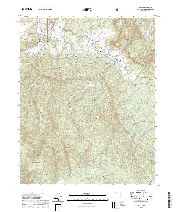
2023 Map of Gallina
USGS Topo · Published 2023About this map
Gallina serves as the primary gateway to the high-elevation wilderness of northern New Mexico, situated along the Rio Gallina. The landscape transitions from the riparian corridor of the river valley up to the heights of French Mesa and Mesa Gurule. This modern survey documents the intricate network of pack trails and water sources essential for navigation in the Santa Fe National Forest, including the Continental Divide National Scenic Trl which traverses the eastern half of the area.
Find a feature on this map
46 named features on this map. Tap any name to fly to it.
Don’t see what you’re looking for? This feature index may not catch every label — zoom into the map to look around manually.
Map Details
Editions of this 2023 Gallina Map
This is the sole edition of this map. No revisions or reprints were ever made.
Other maps of this area

1909 · Gallina
USGS Topo · 1:125,000

1940 · Cuba
USGS Topo · 1:62,500

1943 · Cuba
USGS Topo · 1:62,500

1953 · Arroyo Del Agua
USGS Topo · 1:24,000
1953 · Jarosa
USGS Topo · 1:24,000

1953 · Laguna Peak
USGS Topo · 1:24,000
1953 · Youngsville
USGS Topo · 1:62,500

1954 · Aztec
USGS Topo · 1:250,000

1955 · Llaves
USGS Topo · 1:62,500

1958 · Aztec
USGS Topo · 1:250,000