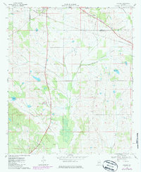
1968 Map of Gallion
USGS Topo · Published 1986About this map
The Southern railroad line cuts through the northern reaches of this rural landscape, connecting the small communities of Gallion and Allenville during the late 1960s. The area, spanning the border of Marengo and Hale counties, is characterized by a dense network of creeks and branches including Cottonwood Creek, Powell Creek, and Little Dry Creek. In contrast to the open wetlands and woods, the settlement pattern is clearly defined by several country churches that serve as local focal points, such as Bethlehem Ch near Allenville and St Pauls Ch further south.
Find a feature on this map
19 named features on this map. Tap any name to fly to it.
Don’t see what you’re looking for? This feature index may not catch every label — zoom into the map to look around manually.
Map Details
Editions of this 1968 Gallion Map
3 editions found
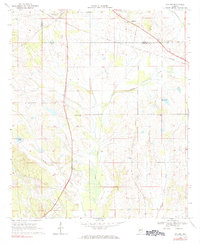
Other maps of this area

1946 · Demopolis
USGS Topo · 1:24,000

1947 · Demopolis
USGS Topo · 1:24,000

1953 · Montgomery
USGS Topo · 1:250,000

1956 · Montgomery
USGS Topo · 1:250,000

1957 · Montgomery
USGS Topo · 1:250,000

1968 · Thomaston East
USGS Topo · 1:24,000

1968 · Uniontown West
USGS Topo · 1:24,000

1968 · Thomaston West
USGS Topo · 1:24,000

1968 · Gallion
USGS Topo · 1:24,000

1970 · Old Spring Hill
USGS Topo · 1:24,000