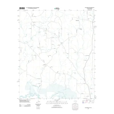
2013 Map of Galloway
USGS Topo · Published 2013About this map
The Sabine River and the northern reaches of the Toledo Bend Reservoir dominate the southern landscape of this Panola County borderland. In the early 21st century, the rural communities of Galloway and Logan remain anchored by a network of county roads and family-named landmarks. The extraction economy is centered on the Belle Bower Oil and Gas Field near the settlement of Belle Bower. Several cemeteries, including Hogeye Cem and Reeves Cem, provide critical points of interest for genealogists tracing local families near the Texas-Louisiana state line. The terrain is defined by a series of drainage systems, with Socagee Cr, Mill Cr, and Garrison Cr winding toward the river, illustrating the persistent importance of natural watercourses in shaping local property lines and settlement patterns.
Find a feature on this map
60 named features on this map. Tap any name to fly to it.
Don’t see what you’re looking for? This feature index may not catch every label — zoom into the map to look around manually.
Map Details
Editions of this 2013 Galloway Map
This is the sole edition of this map. No revisions or reprints were ever made.
Other maps of this area

1944 · Logansport
USGS Topo · 1:62,500

1945 · Grand Cane
USGS Topo · 1:62,500

1945 · Socagee Bayou
USGS Topo · 1:62,500

1953 · Alexandria
USGS Topo · 1:250,000

1953 · Palestine
USGS Topo · 1:250,000

1955 · Shreveport
USGS Topo · 1:250,000

1955 · Alexandria
USGS Topo · 1:250,000

1956 · Shreveport
USGS Topo · 1:250,000

1956 · Tyler
USGS Topo · 1:250,000

1956 · Logansport
USGS Topo · 1:62,500