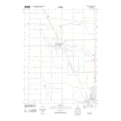
2010 Map of Galveston
USGS Topo · Published 2010About this map
Galveston sits at the center of this agricultural landscape, where the northern expansion of Kokomo begins to meet rural crossroads. The settlement patterns here are defined by a complex network of drainage systems such as Russell Ditch and Charles-Templeton Ditch, which support the surrounding farm tracts. Significant genealogical markers are scattered throughout the quadrangle, including the Patterson Cemetery, Sprinkle Cemetery, and McWilliams Cemetery. Further north, the small community of Lincoln marks a key junction, while Cassville anchors the eastern edge of the survey. The terrain is largely dictated by the winding path of Deer Creek and its tributary, South Fork Deer Creek, which cut through the grid of county roads. The presence of the Galveston Post Office and various family-named burial grounds like Meeks Cemetery and Rush Cemetery provide a clear view of the area's established local history.
Find a feature on this map
60 named features on this map. Tap any name to fly to it.
Don’t see what you’re looking for? This feature index may not catch every label — zoom into the map to look around manually.
Map Details
Editions of this 2010 Galveston Map
This is the sole edition of this map. No revisions or reprints were ever made.
Other maps of this area

1951 · Onward
USGS Topo · 1:24,000

1951 · Bunker Hill
USGS Topo · 1:24,000

1953 · Danville
USGS Topo · 1:250,000

1955 · Danville
USGS Topo · 1:250,000

1955 · Anoka
USGS Topo · 1:24,000

1956 · Danville
USGS Topo · 1:250,000

1959 · Galveston
USGS Topo · 1:24,000

1959 · Miami
USGS Topo · 1:24,000

1959 · Young America
USGS Topo · 1:24,000

1960 · Kokomo West
USGS Topo · 1:24,000