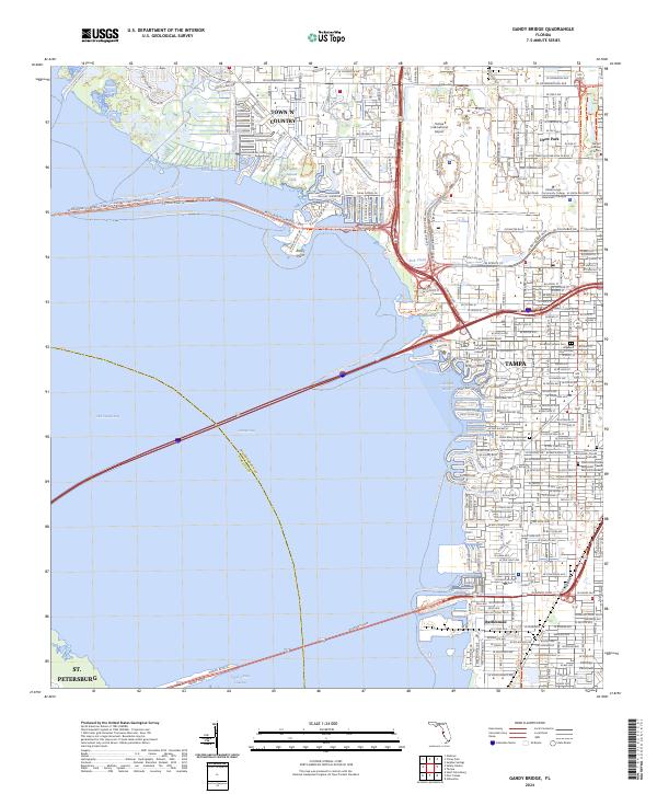
2024 Map of Gandy Bridge
USGS Topo · Published 2024About this map
Tampa's western waterfront and the upper reaches of Old Tampa Bay define this 2024 survey, illustrating the dense suburban and industrial landscape of modern Hillsborough County. The map details established neighborhoods like Drew Park and the settlement of Rattlesnake on the Interbay Peninsula, alongside major infrastructure such as the Tampa International Airport and the complex web of the Courtney Campbell Causeway. A network of recreation trails, including the Tampa Bay Westshore Trail and Sol Fleishman Park Trail, reflects the area's contemporary development.
Find a feature on this map
50 named features on this map. Tap any name to fly to it.
Don’t see what you’re looking for? This feature index may not catch every label — zoom into the map to look around manually.
Map Details
Editions of this 2024 Gandy Bridge Map
This is the sole edition of this map. No revisions or reprints were ever made.
Other maps of this area

1921 · Tampa
USGS Topo · 1:62,500

1921 · St Petersburg
USGS Topo · 1:62,500

1943 · St Petersburg
USGS Topo · 1:31,680

1943 · Gandy Bridge
USGS Topo · 1:31,680

1943 · Safety Harbor
USGS Topo · 1:31,680

1943 · Port Tampa
USGS Topo · 1:31,680

1943 · Oldsmar
USGS Topo · 1:24,000

1944 · Sulphur Springs
USGS Topo · 1:31,680

1944 · Tampa
USGS Topo · 1:31,680

1944 · Oldsmar
USGS Topo · 1:31,680