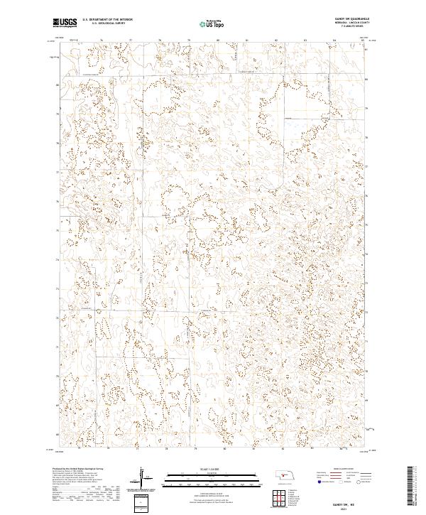
2021 Map of Gandy SW
USGS Topo · Published 2021About this map
The Nebraska Sandhills terrain dominates this corner of Lincoln County, where the landscape is defined by the transition between the elevated tablelands and the undulating dune formations. E Garfield Table Rd and Garfield Cemetery Rd serve as vital north-south and east-west arteries for this ranching region, following the surveyed section lines typical of the Public Land Survey System. The network of rural roads, including N Kiewitt Rd and E Niedan Rd, reveals a settlement pattern dictated by the unique topography of the hills, where access often follows the natural low-lying paths between ridges. While the map is sparse of urban centers, the presence of specific family and local road names like Auble Rd and Kilmar Rd provides a crucial record of land usage and lineage in this section of the state.
Find a feature on this map
13 named features on this map. Tap any name to fly to it.
Don’t see what you’re looking for? This feature index may not catch every label — zoom into the map to look around manually.
Map Details
Editions of this 2021 Gandy SW Map
This is the sole edition of this map. No revisions or reprints were ever made.
Other maps of this area

1899 · North Platte
USGS Topo · 1:125,000

1902 · North Platte
USGS Topo · 1:125,000

1954 · North Platte
USGS Topo · 1:250,000

1956 · North Platte
USGS Topo · 1:250,000

1957 · North Platte
USGS Topo · 1:250,000

1967 · North Platte
USGS Topo · 1:250,000
1970 · Maxwell NE
USGS Topo · 1:24,000
1972 · Stapleton
USGS Topo · 1:24,000

1972 · Logan
USGS Topo · 1:24,000
1972 · Stapleton SE
USGS Topo · 1:24,000