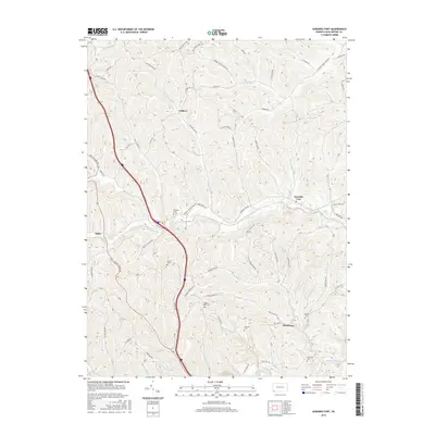
2016 Map of Garards Fort
USGS Topo · Published 2016About this map
Garards Fort and the surrounding township of Greene County are defined by a complex drainage network that has shaped rural settlement patterns for generations. The landscape is carved by the winding Whiteley Creek and its many tributaries, including Frosty Run and Woods Run, which dictate the paths of early thoroughfares like Garards Fort Rd. Genealogists will find a wealth of family history preserved in numerous burial grounds across the hills, from Whiteley Cem near the fork to Mason Ridge Cem and Steele Cem further south. The small hamlets of Kirby and Davistown serve as anchors in this undulating terrain, where ridges like Blaker Ridge separate narrow valley runs. Toward the southern border, the topography descends toward Dunkard Creek, illustrating the transition from upland farm roads to the deeper stream valleys that define the Pennsylvania-West Virginia borderlands.
Find a feature on this map
71 named features on this map. Tap any name to fly to it.
Don’t see what you’re looking for? This feature index may not catch every label — zoom into the map to look around manually.
Map Details
Editions of this 2016 Garards Fort Map
This is the sole edition of this map. No revisions or reprints were ever made.
Other maps of this area

1900 · Masontown
USGS Topo · 1:62,500

1901 · Waynesburg
USGS Topo · 1:62,500

1902 · Morgantown
USGS Topo · 1:62,500

1903 · Masontown
USGS Topo · 1:62,500

1904 · Blacksville
USGS Topo · 1:62,500

1904 · Waynesburg
USGS Topo · 1:62,500

1923 · Blacksville
USGS Topo · 1:62,500

1925 · Blacksville
USGS Topo · 1:62,500

1925 · Morgantown
USGS Topo · 1:62,500

1931 · Masontown
USGS Topo · 1:62,500