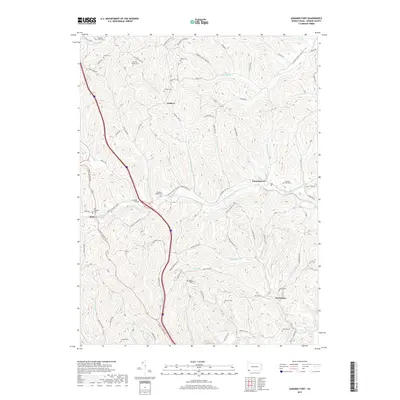
2019 Map of Garards Fort
USGS Topo · Published 2019About this map
Garards Fort and the surrounding hill country of Greene County are defined by a dense network of family cemeteries and rural settlements. This landscape is intricately carved by numerous waterways, including Whiteley Cr and Meadow Run, which dictate the winding paths of local routes like Kirby Garards Fort Rd. The map reveals a high concentration of burial sites such as the Hickman Family Cem, Rinehart-Scott Cem, and the Old Ironsides Cem, suggesting long-established family homesteads scattered across the ridges and hollows. Small communities like Fordyce and Davistown serve as anchor points along the upland terrain of Blaker Ridge. This modern survey documents the persistent rural character of Dunkard Township, where the geography of the land remains deeply tied to the ancestral names found at sites like Mason-Ridge Cem and Johnson Cem.
Find a feature on this map
77 named features on this map. Tap any name to fly to it.
Don’t see what you’re looking for? This feature index may not catch every label — zoom into the map to look around manually.
Map Details
Editions of this 2019 Garards Fort Map
This is the sole edition of this map. No revisions or reprints were ever made.
Other maps of this area

1900 · Masontown
USGS Topo · 1:62,500

1901 · Waynesburg
USGS Topo · 1:62,500

1902 · Morgantown
USGS Topo · 1:62,500

1903 · Masontown
USGS Topo · 1:62,500

1904 · Blacksville
USGS Topo · 1:62,500

1904 · Waynesburg
USGS Topo · 1:62,500

1923 · Blacksville
USGS Topo · 1:62,500

1925 · Blacksville
USGS Topo · 1:62,500

1925 · Morgantown
USGS Topo · 1:62,500

1931 · Masontown
USGS Topo · 1:62,500