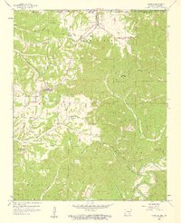
1958 Map of Garfield
USGS Topo · Published 1959About this map
Garfield and the neighboring settlements of Gateway and Clantonville sit atop the high ridges of the Ozark plateau during the late 1950s. The St Louis San Francisco railroad cuts a definitive path through the landscape, dictating the placement of community centers like Bayless Sch and the Clantonville Cem. The terrain is defined by a series of prominent heights, including Garfield Mountain, Sugar Mountain, and Humphery Mountain, which separate the various hollows feeding into the White River valley to the south.
Find a feature on this map
46 named features on this map. Tap any name to fly to it.
Don’t see what you’re looking for? This feature index may not catch every label — zoom into the map to look around manually.
Map Details
Editions of this 1958 Garfield Map
4 editions found
Other maps of this area

1899 · Fayetteville
USGS Topo · 1:125,000

1900 · Eureka Springs
USGS Topo · 1:125,000

1901 · Eureka Springs
USGS Topo · 1:125,000

1901 · Fayetteville
USGS Topo · 1:125,000

1904 · Fayetteville
USGS Topo · 1:125,000
1937 · Cassville
USGS Topo · 1:48,000
1941 · Rocky Comfort
USGS Topo · 1:62,500
1943 · Rocky Comfort
USGS Topo · 1:62,500
1944 · Cassville
USGS Topo · 1:62,500

1945 · Harrison
USGS Topo · 1:250,000