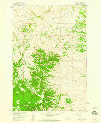
1958 Map of Garfield Peak
USGS Topo · Published 1960About this map
Garfield Peak stands as the dominant topographical landmark in this 1950s survey of Rosebud County, where the landscape is defined by the high divides between the Tongue River and Rosebud Creek watersheds. A striking historical marker is the Old Indian Reservation Boundary which traverses the center of the quadrangle, reflecting the complex territorial history of the region.
Find a feature on this map
19 named features on this map. Tap any name to fly to it.
Don’t see what you’re looking for? This feature index may not catch every label — zoom into the map to look around manually.
Map Details
Editions of this 1958 Garfield Peak Map
3 editions found
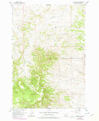
Other maps of this area

1954 · Hardin
USGS Topo · 1:250,000

1957 · Hardin
USGS Topo · 1:250,000

1958 · Hardin
USGS Topo · 1:250,000

1958 · Garfield Peak
USGS Topo · 1:24,000

1958 · Fisher Butte
USGS Topo · 1:24,000

1958 · Badger Peak
USGS Topo · 1:24,000

1958 · Hollowwood Creek
USGS Topo · 1:24,000

1966 · Ashland
USGS Topo · 1:24,000

1966 · Ashland NE
USGS Topo · 1:24,000

1971 · Colstrip SE
USGS Topo · 1:24,000