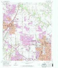
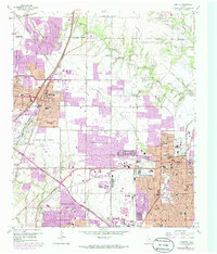
1959 Map of Garland
USGS Topo · Published 1974About this map
Garland and Richardson are seen here during a period of massive suburban expansion in the Dallas-Fort Worth metroplex. This survey, based on 1950s data with early 1970s revisions, documents the residential infill between established centers and the outlying settlements of Buckingham and Audelia. The landscape is a mix of planned developments and remnant agricultural landmarks, such as Big Springs Ch and the Blewett Cem.
Find a feature on this map
58 named features on this map. Tap any name to fly to it.
Don’t see what you’re looking for? This feature index may not catch every label — zoom into the map to look around manually.
Map Details
Editions of this 1959 Garland Map
5 editions found
Other maps of this area

1891 · Dallas
USGS Topo · 1:125,000

1893 · Dallas
USGS Topo · 1:125,000

1924 · Mc Kinney 4-d
USGS Topo · 1:48,000

1929 · Frisco
USGS Topo · 1:62,500

1929 · McKinney
USGS Topo · 1:62,500

1931 · Carrollton
USGS Topo · 1:62,500

1954 · Dallas
USGS Topo · 1:250,000

1954 · Sherman
USGS Topo · 1:250,000

1957 · White Rock Lake
USGS Topo · 1:24,000

1958 · Dallas
USGS Topo · 1:250,000