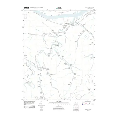
2010 Map of Garrison
USGS Topo · Published 2010About this map
The Ohio River frontage defines the northern border of this region, serving as a historic corridor for river traffic at Morrisons Landing, Elliots Landing, and McAtee Landing. The settlement of Garrison is a central hub, accompanied by the Garrison Post Office and the neighboring community of Quincy further east. Further inland, the landscape is deeply etched by Kinniconick Creek and its many tributaries, creating a complex system of hollows such as Negro Hollow and Peach Orchard Hollow. Genealogy researchers will find numerous family-associated burial sites across these ridges, including the Howland Cemetery, Waring Cemetery, and Skidmore Cemetery. The southern portion of the area includes the small settlement of Tannery, located where the creek winds through the hills, illustrating the traditional rural development patterns of Lewis County.
Find a feature on this map
120 named features on this map. Tap any name to fly to it.
Don’t see what you’re looking for? This feature index may not catch every label — zoom into the map to look around manually.
Map Details
Editions of this 2010 Garrison Map
This is the sole edition of this map. No revisions or reprints were ever made.
Other maps of this area

1915 · Garrison
USGS Topo · 1:62,500

1918 · Garrison
USGS Topo · 1:62,500

1919 · Vanceburg
USGS Topo · 1:62,500

1949 · Pond Run
USGS Topo · 1:24,000

1949 · Vanceburg
USGS Topo · 1:62,500

1949 · Garrison
USGS Topo · 1:24,000

1949 · Friendship
USGS Topo · 1:24,000

1949 · Buena Vista
USGS Topo · 1:24,000

1949 · Vanceburg
USGS Topo · 1:24,000

1949 · Brushart
USGS Topo · 1:24,000