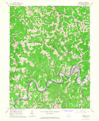
1965 Map of Gassaway
USGS Topo · Published 1967About this map
The Elk River winds in deep loops through this 1965 survey, defining the industrial and social life of the Braxton County landscape. At the center of the river's largest bend, Gassaway serves as a major hub where the Baltimore and Ohio railroad follows the water's edge. The town's development is marked by local landmarks like the Bealls Mill Cem, a Drive-in Theater, and a riverside Golf Course. Downstream to the southwest, the smaller settlement of Frametown sits near the mouth of Stumble Run, illustrating how early West Virginia communities clustered at the confluence of major runs and the river.
Find a feature on this map
73 named features on this map. Tap any name to fly to it.
Don’t see what you’re looking for? This feature index may not catch every label — zoom into the map to look around manually.
Map Details
Editions of this 1965 Gassaway Map
2 editions found
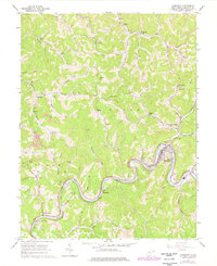
Other maps of this area

1893 · Sutton
USGS Topo · 1:125,000

1906 · Glenville
USGS Topo · 1:62,500

1906 · Burnsville
USGS Topo · 1:62,500

1908 · Gassaway
USGS Topo · 1:48,000

1908 · Sutton
USGS Topo · 1:48,000

1910 · Sutton Special
USGS Topo · 1:62,500

1910 · Gassaway
USGS Topo · 1:62,500

1925 · Glenville
USGS Topo · 1:62,500

1925 · Burnsville
USGS Topo · 1:62,500

1927 · Burnsville
USGS Topo · 1:62,500