
1962 Map of Gateway
USGS Topo · Published 1964About this map
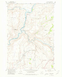
Gateway stands as the primary hub in this arid landscape of North-Central Oregon, positioned where the high Agency Plains meet the complex drainage systems of the Deschutes River. The terrain is deeply incised by water and history, featuring the steep walls of Old Maids Canyon and the prominent Lyle Gap. This area served as a critical corridor for rail transportation in the early 1960s, evidenced by the competing paths of the Spokane Portland and Seattle and the Oregon Trunk lines that snake through the river canyons.
Find a feature on this map
25 named features on this map. Tap any name to fly to it.
Don’t see what you’re looking for? This feature index may not catch every label — zoom into the map to look around manually.
Map Details
Editions of this 1962 Gateway Map
4 editions found
Other maps of this area

1928 · Madras
USGS Topo · 1:125,000

1931 · Madras
USGS Topo · 1:125,000

1955 · Bend
USGS Topo · 1:250,000

1957 · Bend
USGS Topo · 1:250,000

1958 · Bend
USGS Topo · 1:250,000
1962 · Kaskela
USGS Topo · 1:24,000

1962 · Eagle Butte
USGS Topo · 1:24,000
1962 · Mutton Mtn
USGS Topo · 1:24,000
1963 · Madras West
USGS Topo · 1:24,000
1963 · Madras East
USGS Topo · 1:24,000