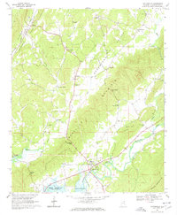
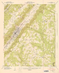
1967 Map of Gaylesville
USGS Topo · Published 1967About this map
Gaylesville sits at the foot of Dirtseller mountain, where the valley floor meets the winding path of the Chattooga River. In the late 1960s, the landscape reflected a deeply established rural community defined by numerous small country churches and family landmarks. The map documents religious and social centers such as Jamestown Tabernacle, Oak Bowery Ch, and Dixon Mem Ch, alongside several cemeteries including Cannon Cem.
Find a feature on this map
46 named features on this map. Tap any name to fly to it.
Don’t see what you’re looking for? This feature index may not catch every label — zoom into the map to look around manually.
Map Details
Editions of this 1967 Gaylesville Map
4 editions found
Other maps of this area

1886 · Rome
USGS Topo · 1:125,000

1893 · Fort Payne
USGS Topo · 1:125,000

1898 · Rome
USGS Topo · 1:125,000

1898 · Fort Payne
USGS Topo · 1:125,000

1899 · Rome
USGS Topo · 1:125,000

1900 · Fort Payne
USGS Topo · 1:125,000

1904 · Rome
USGS Topo · 1:125,000

1946 · Ft Payne
USGS Topo · 1:24,000
1947 · Ft Payne
USGS Topo · 1:24,000

1955 · Rome
USGS Topo · 1:250,000