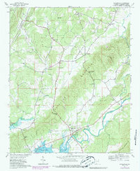
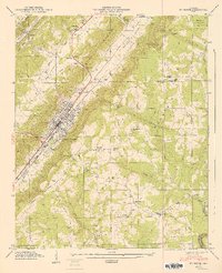
1967 Map of Gaylesville
USGS Topo · Published 1987About this map
Gaylesville anchors the southern landscape of this Northeast Alabama quadrangle, situated where the Chattooga River meets the expansive waters of Weiss Lake. The terrain is sharply defined by the parallel ridges of Shinbone Ridge and Broomtown Mountain, which cradle the productive agricultural lands of the Broomtown Valley. The map reveals a deeply established rural community structured around small settlements like Watson, Blanche, and Broomtown, and provides significant genealogical detail through its inventory of local landmarks. Notable sites for researchers include Union Hill Ch, the Jamestown Tabernacle, and family-named locations such as McCullough Gap and Cannon Cem. The inclusion of fence and field lines, updated via photogrammetric methods from the 1960s through the 1980s, offers a precise look at land use patterns and rural homesteads during this period of mid-century growth.
Find a feature on this map
45 named features on this map. Tap any name to fly to it.
Don’t see what you’re looking for? This feature index may not catch every label — zoom into the map to look around manually.
Map Details
Editions of this 1967 Gaylesville Map
4 editions found
Other maps of this area

1886 · Rome
USGS Topo · 1:125,000

1893 · Fort Payne
USGS Topo · 1:125,000

1898 · Rome
USGS Topo · 1:125,000

1898 · Fort Payne
USGS Topo · 1:125,000

1899 · Rome
USGS Topo · 1:125,000

1900 · Fort Payne
USGS Topo · 1:125,000

1904 · Rome
USGS Topo · 1:125,000

1946 · Ft Payne
USGS Topo · 1:24,000
1947 · Ft Payne
USGS Topo · 1:24,000

1955 · Rome
USGS Topo · 1:250,000