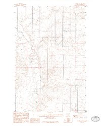
1983 Map of Geddart Lake
USGS Topo · Published 1983About this map
The Poplar River meanders across this Roosevelt County landscape, defining the topography of the northern plains. This 1983 provisional survey highlights a rural environment where water management and industrial infrastructure are central to land use. Notable features like Geddart Lake and the drainage of Kirns Coulee suggest a reliance on seasonal and permanent water sources for the area's agricultural operations. The landscape is marked by the presence of a Pipe Line and clusters of Grain Bins and Tanks, indicating a specialized economy focused on storage and transport. The transition between t30n and t29n townships provides a clear view of the Public Land Survey System as it was applied to the northeastern Montana prairie during the late twentieth century.
Find a feature on this map
8 named features on this map. Tap any name to fly to it.
Don’t see what you’re looking for? This feature index may not catch every label — zoom into the map to look around manually.
Map Details
Editions of this 1983 Geddart Lake Map
2 editions found
Other maps of this area

1909 · Smoke Creek
USGS Topo · 1:62,500

1912 · Hay Creek
USGS Topo · 1:62,500

1912 · Poplar
USGS Topo · 1:62,500

1912 · Smoke Creek
USGS Topo · 1:62,500

1914 · Brockton
USGS Topo · 1:62,500

1954 · Wolf Point
USGS Topo · 1:250,000

1958 · Wolf Point
USGS Topo · 1:250,000

1972 · Poplar NE
USGS Topo · 1:24,000
1972 · Badger Creek
USGS Topo · 1:24,000
1972 · Brockton
USGS Topo · 1:24,000