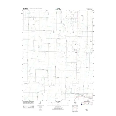
2012 Map of Geff
USGS Topo · Published 2012About this map
Geff serves as a central hub for this portion of Wayne County, where E Mechanic St and W Mechanic St intersect with the rural road network. The landscape is defined by the winding paths of several waterways, including Deer Cr, Martin Cr, and Walton Cr, which drain the agricultural land around the settlement of Covington. To the north, In-Dan Wayne Lake provides a localized water feature amid the grid of county roads.
Find a feature on this map
47 named features on this map. Tap any name to fly to it.
Don’t see what you’re looking for? This feature index may not catch every label — zoom into the map to look around manually.
Map Details
Editions of this 2012 Geff Map
This is the sole edition of this map. No revisions or reprints were ever made.
Other maps of this area

1947 · Wayne City
USGS Topo · 1:62,500

1948 · Fairfield
USGS Topo · 1:62,500

1948 · Flora
USGS Topo · 1:62,500

1949 · Flora
USGS Topo · 1:62,500

1952 · Xenia
USGS Topo · 1:62,500

1958 · Belleville
USGS Topo · 1:250,000

1962 · Belleville
USGS Topo · 1:250,000
1968 · Johnsonville
USGS Topo · 1:24,000

1970 · Enterprise
USGS Topo · 1:24,000
1970 · Cisne
USGS Topo · 1:24,000