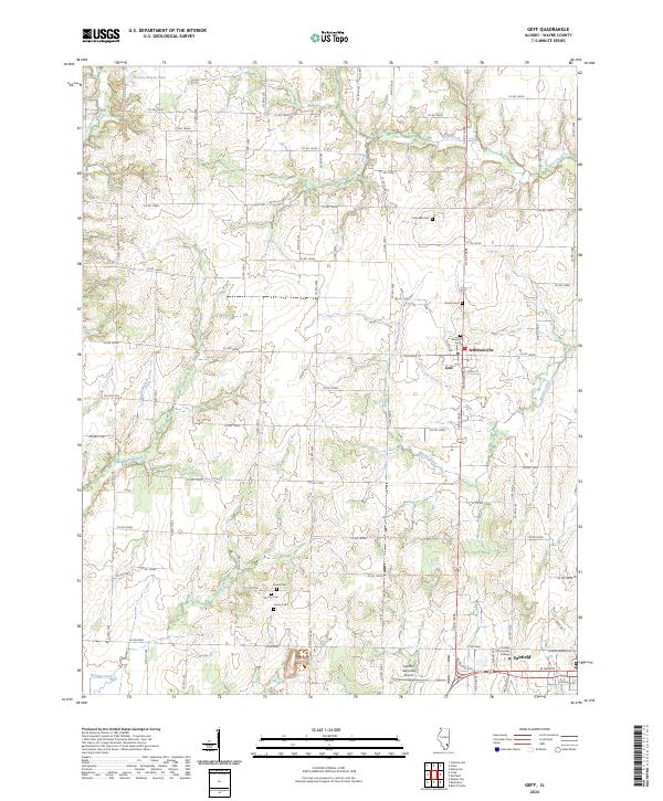
2024 Map of Geff
USGS Topo · Published 2024About this map
Jeffersonville and the neighboring community of Geff anchor this Wayne County landscape, where agricultural land is partitioned by a grid of well-maintained county roads and punctuated by several family and community burial grounds. To the south, the expansion of Fairfield is evident, including the campus of Frontier Community College and the Fairfield Municipal Airport. This area is defined by its subtle drainage patterns, with Martin Creek and Walton Creek meandering through the terrain toward larger basins.
Find a feature on this map
74 named features on this map. Tap any name to fly to it.
Don’t see what you’re looking for? This feature index may not catch every label — zoom into the map to look around manually.
Map Details
Editions of this 2024 Geff Map
This is the sole edition of this map. No revisions or reprints were ever made.
Other maps of this area

1947 · Wayne City
USGS Topo · 1:62,500

1948 · Fairfield
USGS Topo · 1:62,500

1948 · Flora
USGS Topo · 1:62,500

1949 · Flora
USGS Topo · 1:62,500

1952 · Xenia
USGS Topo · 1:62,500

1958 · Belleville
USGS Topo · 1:250,000

1962 · Belleville
USGS Topo · 1:250,000
1968 · Johnsonville
USGS Topo · 1:24,000

1970 · Enterprise
USGS Topo · 1:24,000
1970 · Cisne
USGS Topo · 1:24,000