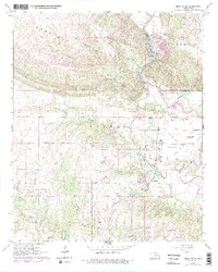
1964 Map of Gene Autry
USGS Topo · Published 1978About this map
The Washita River snakes through the eastern portion of this landscape, carving a path between the Arbuckle Mountains and the Morgan plateau. In the mid-1960s, the settlement of Gene Autry served as a central hub, situated along the Atchison Topeka and Santa Fe railroad line. The map reveals a transition from the industrial activity at Crusher and various quarries near the river to the aviation infrastructure of the Ardmore Municipal Airport further south.
Find a feature on this map
32 named features on this map. Tap any name to fly to it.
Don’t see what you’re looking for? This feature index may not catch every label — zoom into the map to look around manually.
Map Details
Editions of this 1964 Gene Autry Map
3 editions found
Other maps of this area

1901 · Tishomingo
USGS Topo · 1:125,000

1901 · Ardmore
USGS Topo · 1:125,000

1918 · Ardmore
USGS Topo · 1:125,000

1957 · Ardmore
USGS Topo · 1:250,000

1963 · Ardmore
USGS Topo · 1:250,000

1963 · Mannsville
USGS Topo · 1:24,000

1963 · Sulphur South
USGS Topo · 1:24,000

1963 · Nebo
USGS Topo · 1:24,000

1964 · Ardmore East
USGS Topo · 1:24,000

1964 · Ardmore West
USGS Topo · 1:24,000