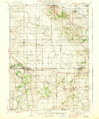
1938 Map of Genoa
USGS Topo · Published 1938About this map
The Genoa region in the 1930s is defined by a dense network of railroads and rural schools serving the farmsteads of DeKalb, Kane, and McHenry counties. Major rail lines including the Chicago Milwaukee ST Paul And Pacific and the Chicago Great Western converge at the village of Genoa, while the Illinois Central passes through Kingston and Henrietta. The landscape is characterized by its agricultural heritage, evidenced by the numerous named rural schoolhouses such as Hickory Grove Sch, Oak Glen Sch, and Bean Sch that anchored these farming communities before district consolidation. The South Branch Kishwaukee River and its tributaries like Coon Creek provide the primary drainage for the area, flowing near established settlements like Burlington and Union. Genealogists may find value in the location of the North Kingston Cem and various family-named landmarks that indicate early landownership patterns.
Find a feature on this map
75 named features on this map. Tap any name to fly to it.
Don’t see what you’re looking for? This feature index may not catch every label — zoom into the map to look around manually.
Map Details
Editions of this 1938 Genoa Map
3 editions found

Other maps of this area

1918 · Belvidere
USGS Topo · 1:62,500

1918 · Kirkland
USGS Topo · 1:62,500

1925 · Elgin
USGS Topo · 1:62,500

1926 · Mc Henry
USGS Topo · 1:62,500

1932 · Harvard
USGS Topo · 1:48,000

1932 · Geneva
USGS Topo · 1:62,500

1934 · De Kalb
USGS Topo · 1:62,500

1937 · De Kalb
USGS Topo · 1:62,500

1937 · Sycamore
USGS Topo · 1:62,500

1937 · Harvard
USGS Topo · 1:62,500