
1962 Map of Genoa
USGS Topo · Published 1963About this map
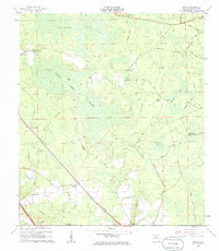
Swift Creek meanders through the heart of Hamilton County, Florida, defining a landscape dominated by timber-related settlements and low-lying wetlands. The rail line of the Southern RR cuts a straight diagonal across the terrain, serving the small community at Genoa and connecting local turpentine or logging operations such as Blacks Still and Camps Still. The presence of several country churches, including Friendship Ch, Spring Branch Ch, and Camp Branch Ch, alongside their associated burial grounds like Spring Branch Cem, suggests a dispersed but well-established rural social network in the early 1960s.
Find a feature on this map
42 named features on this map. Tap any name to fly to it.
Don’t see what you’re looking for? This feature index may not catch every label — zoom into the map to look around manually.
Map Details
Editions of this 1962 Genoa Map
3 editions found
Other maps of this area

1954 · Valdosta
USGS Topo · 1:250,000

1955 · Jasper
USGS Topo · 1:24,000

1955 · Cypress Creek
USGS Topo · 1:24,000

1955 · Fargo SW
USGS Topo · 1:24,000

1958 · Valdosta
USGS Topo · 1:250,000

1959 · Valdosta
USGS Topo · 1:250,000

1961 · Live Oak East
USGS Topo · 1:24,000

1961 · Hillcoat
USGS Topo · 1:24,000

1961 · White Springs East
USGS Topo · 1:24,000

1961 · White Springs West
USGS Topo · 1:24,000