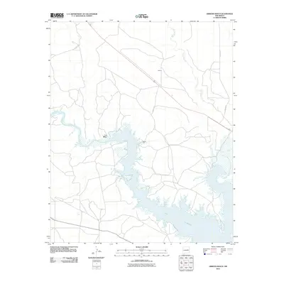
2010 Map of Gibbons Ranch
USGS Topo · Published 2010About this map
Lake Semner dominates the southern landscape of this quadrangle, formed by the impoundment of the Pecos River. The map illustrates a rural ranching environment characterized by wide-reaching arroyos and localized settlements. Los Ojitos sits along the northwestern banks of the reservoir, while Gibbons Ranch and the locality of Gibbons are situated further east and north, respectively. A network of county roads, including County Rd 2 and County Rd 2F, provides access across the arid terrain. The mapping of Arroyo Potrillo in the northeast shows the complex drainage patterns that define this part of Guadalupe County, reflecting the area's hydrology and land use during the early 21st century. This survey records the intersection of modern infrastructure with the natural water systems of the New Mexico plains.
Find a feature on this map
11 named features on this map. Tap any name to fly to it.
Don’t see what you’re looking for? This feature index may not catch every label — zoom into the map to look around manually.
Map Details
Editions of this 2010 Gibbons Ranch Map
This is the sole edition of this map. No revisions or reprints were ever made.
Other maps of this area

1954 · Fort Sumner
USGS Topo · 1:250,000

1958 · Fort Sumner
USGS Topo · 1:250,000

1963 · Puerto De Luna
USGS Topo · 1:24,000

1964 · Canada Colorado
USGS Topo · 1:24,000

1964 · Fallon Ranch
USGS Topo · 1:24,000

1965 · Windmill Draw
USGS Topo · 1:24,000

1966 · Gibbons Ranch
USGS Topo · 1:24,000

1966 · Ojo Negro Creek
USGS Topo · 1:24,000

1966 · Alamogordo Dam
USGS Topo · 1:24,000

1966 · Cooper Ranch
USGS Topo · 1:24,000