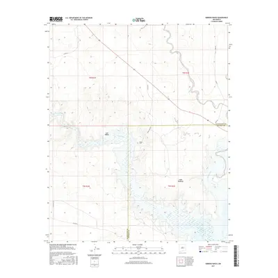
2017 Map of Gibbons Ranch
USGS Topo · Published 2017About this map
Los Ojitos sits at a critical bend where the Pecos River enters the northern reaches of Lake Sumner. This landscape is defined by its drainage systems, where the perennial river meets seasonal waterways like Arroyo Potrillo and Alamogordo Creek. The map documents a sparsely populated ranching territory at the border of Guadalupe Co De Baca Co, centered on the namesake Gibbons Ranch. Surveyed in the late 2010s, the terrain reveals an intricate network of local thoroughfares including Smokey Draw Rd, Cake Ranch Rd, and Falcon Rd, which connect remote homesteads across the arid plains of east-central New Mexico. The transition from high desert draws to the riparian wetlands of the reservoir creates a distinct ecological and topographic boundary that has historically dictated the placement of settlements and cattle operations in this region.
Find a feature on this map
19 named features on this map. Tap any name to fly to it.
Don’t see what you’re looking for? This feature index may not catch every label — zoom into the map to look around manually.
Map Details
Editions of this 2017 Gibbons Ranch Map
This is the sole edition of this map. No revisions or reprints were ever made.
Other maps of this area

1954 · Fort Sumner
USGS Topo · 1:250,000

1958 · Fort Sumner
USGS Topo · 1:250,000

1963 · Puerto De Luna
USGS Topo · 1:24,000

1964 · Canada Colorado
USGS Topo · 1:24,000

1964 · Fallon Ranch
USGS Topo · 1:24,000

1965 · Windmill Draw
USGS Topo · 1:24,000

1966 · Gibbons Ranch
USGS Topo · 1:24,000

1966 · Ojo Negro Creek
USGS Topo · 1:24,000

1966 · Alamogordo Dam
USGS Topo · 1:24,000

1966 · Cooper Ranch
USGS Topo · 1:24,000