Loading...
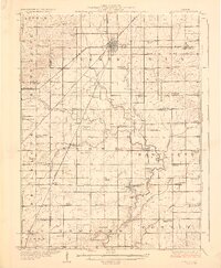
Loading map...1928 Map of Gibson City
USGS Topo · Published 1928About this map
Gibson City serves as a major rail hub in this late 1920s landscape, where the Illinois Central, Wabash, and New York Chicago and St Louis railroads converge. The map documents a dense network of rural infrastructure supporting the surrounding agricultural townships of Drummer, Dix, and Brown. A remarkable concentration of one-room schoolhouses, such as Scotland School, Antioch School, and Oregon School, reflects the decentralized nature of local education before the era of school consolidation.
Find a feature on this map
75 named features on this map. Tap any name to fly to it.
Don’t see what you’re looking for? This feature index may not catch every label — zoom into the map to look around manually.
Map Details
Date Portrayed1928
Date Published1928
PublisherU.S. Geological Survey
Map TypeTopographic
Scale1:62,500
Physical Dimensions16.41 x 19.94 inches
Editions of this 1928 Gibson City Map
2 editions found
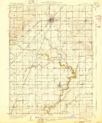
Historical Maps of Gibson City Through Time
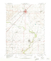
Featured Locations
Source Details
SourceU.S. Geological Survey
CopyrightPublic Domain