
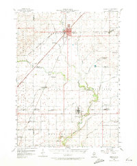
1957 Map of Gibson City
USGS Topo · Published 1958About this map
Gibson City serves as the primary rail hub on this mid-century survey, situated at the junction of the Wabash, New York Chicago and St Louis, and Illinois Central railroads. The surrounding prairie landscape is defined by the headwaters of the Sangamon River and its various tributaries, including Drummer Creek and Lone Tree Creek. This era of the Illinois countryside shows a transition in rural education, with several one-room schoolhouses such as Skeel Sch and Sangamon Sch marked as abandoned, while the central High School in town reflects the consolidation of the period. Smaller hamlets like Elliott and Foosland dot the grid of farm roads, anchored by local institutions like Pontoppidan Ch and the Walker Ch. The presence of a Drive-in Theater and Sewage Disposal plant near the city limits captures the postwar expansion of local infrastructure.
Find a feature on this map
71 named features on this map. Tap any name to fly to it.
Don’t see what you’re looking for? This feature index may not catch every label — zoom into the map to look around manually.
Map Details
Editions of this 1957 Gibson City Map
2 editions found
Other maps of this area

1906 · Urbana
USGS Topo · 1:62,500

1907 · Mahomet
USGS Topo · 1:62,500

1924 · Paxton
USGS Topo · 1:62,500

1927 · Paxton
USGS Topo · 1:62,500

1928 · Gibson City
USGS Topo · 1:62,500

1937 · Monticello
USGS Topo · 1:48,000

1943 · Monticello
USGS Topo · 1:62,500

1947 · Sibley
USGS Topo · 1:62,500

1948 · Buckley
USGS Topo · 1:62,500

1949 · Buckley
USGS Topo · 1:62,500