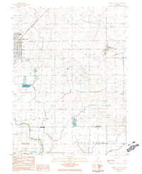
1983 Map of Gibson City East
USGS Topo · Published 1983About this map
The agricultural landscape of Ford and Champaign County is centered on the rail hub of Gibson City, where the Illinois Central Gulf and Norfolk and Western railroads intersect. This 1980s-era documentation captures a transition in local infrastructure, noting the Gibson City Municipal Airport and the nearby Barnes Landing Strip. To the east, the village of Elliott serves as another focal point for the surrounding farms of Dix and Drummer townships.
Find a feature on this map
24 named features on this map. Tap any name to fly to it.
Don’t see what you’re looking for? This feature index may not catch every label — zoom into the map to look around manually.
Map Details
Editions of this 1983 Gibson City East Map
This is the sole edition of this map. No revisions or reprints were ever made.
Other maps of this area

1924 · Paxton
USGS Topo · 1:62,500

1927 · Paxton
USGS Topo · 1:62,500

1928 · Gibson City
USGS Topo · 1:62,500

1947 · Sibley
USGS Topo · 1:62,500

1948 · Buckley
USGS Topo · 1:62,500

1949 · Buckley
USGS Topo · 1:62,500

1949 · Paxton
USGS Topo · 1:62,500

1949 · Sibley
USGS Topo · 1:62,500

1957 · Paxton
USGS Topo · 1:62,500

1957 · Gibson City
USGS Topo · 1:62,500