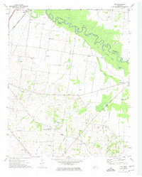
1972 Map of Gift
USGS Topo · Published 1974About this map
The Hatchie River forms the northern boundary of this West Tennessee landscape, carving a meandering path between Lauderdale and Tipton counties. The early 1970s terrain is marked by a transition from the river lowlands to organized agricultural plots and aviation infrastructure, including the Covington Municipal Airport and Glenn Airfield. The settlement patterns are anchored by rural communities like Gift and Solo, where local life centered around numerous small congregations such as Willow Grove Ch and Antioch.
Find a feature on this map
36 named features on this map. Tap any name to fly to it.
Don’t see what you’re looking for? This feature index may not catch every label — zoom into the map to look around manually.
Map Details
Editions of this 1972 Gift Map
2 editions found
Other maps of this area

1952 · Stanton
USGS Topo · 1:24,000

1952 · Stanton
USGS Topo · 1:62,500

1954 · Mason
USGS Topo · 1:62,500

1956 · Blytheville
USGS Topo · 1:250,000

1959 · Blytheville
USGS Topo · 1:250,000

1961 · Rialto
USGS Topo · 1:62,500

1962 · Rialto
USGS Topo · 1:62,500
1964 · Turnpike
USGS Topo · 1:24,000
1964 · Durhamville
USGS Topo · 1:24,000

1965 · Brighton
USGS Topo · 1:24,000