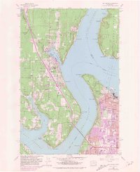
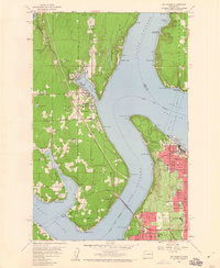
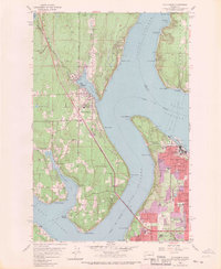
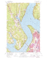
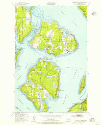
1959 Map of Gig Harbor
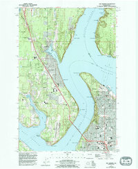
USGS Topo · Published 1981About this map
Gig Harbor and the surrounding Pierce County coastline appear here in a period of significant postwar growth, documented in 1959 with urban expansions updated through the early 1980s. The map captures the complex maritime geography of Colvos Passage and The Narrows, anchored by the critical Tacoma Narrows Bridge connecting the mainland to the Kitsap Peninsula. Along the shoreline, industrial and recreational landmarks define the era, from the Tacoma Smelter and Nelson Bennett Tunnel near Ruston to the historic Fort Nisqually (Restoration) within Point Defiance Park.
Find a feature on this map
66 named features on this map. Tap any name to fly to it.
Don’t see what you’re looking for? This feature index may not catch every label — zoom into the map to look around manually.
Map Details
Editions of this 1959 Gig Harbor Map
5 editions found
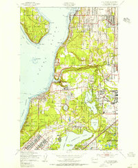
Other maps of this area

1897 · Tacoma
USGS Topo · 1:125,000

1900 · Tacoma
USGS Topo · 1:125,000

1940 · Anderson Island
USGS Topo · 1:62,500

1941 · Tacoma South
USGS Topo · 1:62,500

1942 · Gig Harbor
USGS Topo · 1:62,500

1943 · Gig Harbor
USGS Topo · 1:62,500

1944 · Tacoma South
USGS Topo · 1:62,500

1948 · Anderson Island
USGS Topo · 1:62,500
1948 · Anderson Island
USGS Topo · 1:24,000
1948 · Steilacoom
USGS Topo · 1:24,000