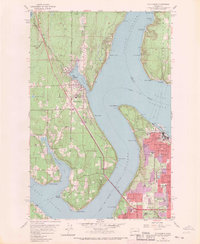
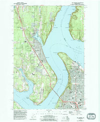
1959 Map of Gig Harbor
USGS Topo · Published 1970About this map
The maritime identity of the Puget Sound is on full display here, as Gig Harbor and Tacoma are separated by the deep waters of The Narrows. This mid-century survey captures the expanding residential footprint of Harbor Heights and Artondale on the western peninsula, while Vashon Island remains largely focused on shoreline settlements like Tahlequah and Spring Beach. The mapping includes significant industrial and civic landmarks, from the Tacoma Smelter and Tacoma Industrial Airport to the cultural site of Fort Nisqually within the expansive Point Defiance Park. The presence of the Tacoma Narrows Bridge signifies the critical transportation link between the Kitsap Peninsula and the city's urban core, illustrating the post-war growth that reshaped these coastal communities. Local researchers can trace family names through landmarks like Swede Hill or locate historical community anchors such as the Gig Harbor Cemetery.
Find a feature on this map
64 named features on this map. Tap any name to fly to it.
Don’t see what you’re looking for? This feature index may not catch every label — zoom into the map to look around manually.
Map Details
Editions of this 1959 Gig Harbor Map
5 editions found
Other maps of this area

1897 · Tacoma
USGS Topo · 1:125,000

1900 · Tacoma
USGS Topo · 1:125,000

1940 · Anderson Island
USGS Topo · 1:62,500

1941 · Tacoma South
USGS Topo · 1:62,500

1942 · Gig Harbor
USGS Topo · 1:62,500

1943 · Gig Harbor
USGS Topo · 1:62,500

1944 · Tacoma South
USGS Topo · 1:62,500

1948 · Anderson Island
USGS Topo · 1:62,500

1948 · Anderson Island
USGS Topo · 1:24,000

1948 · Steilacoom
USGS Topo · 1:24,000