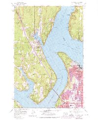
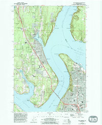
1959 Map of Gig Harbor
USGS Topo · Published 1976About this map
Gig Harbor and the western edge of Tacoma are defined by the intricate waterways of The Narrows, Colvos Passage, and Hale Passage. This 1959 revision illustrates the post-war expansion of residential areas around Harbor Heights and Artondale, with purple-tinted updates from the early 1970s showing the densifying suburban footprint. The landscape transitions from the maritime industry of the Tacoma Smelter and Tacoma Yacht Club to the preserved grounds of Point Defiance Park, featuring a restored Fort Nisqually.
Find a feature on this map
57 named features on this map. Tap any name to fly to it.
Don’t see what you’re looking for? This feature index may not catch every label — zoom into the map to look around manually.
Map Details
Editions of this 1959 Gig Harbor Map
5 editions found
Other maps of this area

1897 · Tacoma
USGS Topo · 1:125,000

1900 · Tacoma
USGS Topo · 1:125,000

1940 · Anderson Island
USGS Topo · 1:62,500

1941 · Tacoma South
USGS Topo · 1:62,500

1942 · Gig Harbor
USGS Topo · 1:62,500

1943 · Gig Harbor
USGS Topo · 1:62,500

1944 · Tacoma South
USGS Topo · 1:62,500

1948 · Anderson Island
USGS Topo · 1:62,500

1948 · Anderson Island
USGS Topo · 1:24,000

1948 · Steilacoom
USGS Topo · 1:24,000