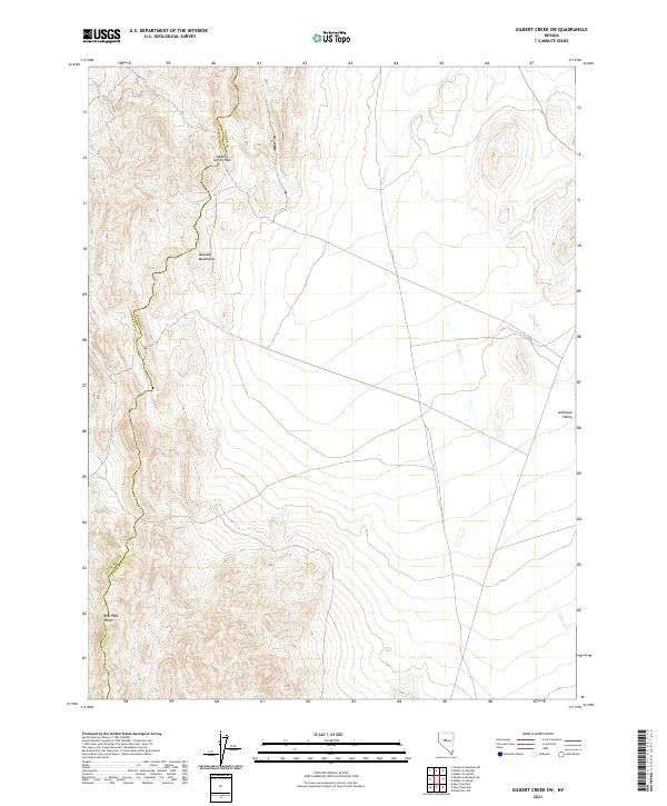
2021 Map of Gilbert Creek SW
USGS Topo · Published 2021About this map
The Augusta Mountains and the New Pass Range dominate this landscape on the border of Churchill and Lander counties. This high-desert terrain is defined by rugged elevation changes, centered around the strategic Soldiers Spring Pass, which provides a natural transit point through the mountain chain. The eastern portion of the map transitions into the wide expanse of the Antelope Valley, where drainage is managed by seasonal watercourses like Antelope Cr and Gilbert Cr. The map illustrates the classic Great Basin basin-and-range structure, showing how the steep mountain slopes give way to alluvial flats. Surveyed in the modern era, the data highlights the persistence of traditional land divisions including t23n r40e and t22n r41e, which have governed this part of Nevada since the nineteenth century.
Find a feature on this map
11 named features on this map. Tap any name to fly to it.
Don’t see what you’re looking for? This feature index may not catch every label — zoom into the map to look around manually.
Map Details
Editions of this 2021 Gilbert Creek SW Map
This is the sole edition of this map. No revisions or reprints were ever made.
Other maps of this area

1955 · Millett
USGS Topo · 1:250,000

1959 · Millett
USGS Topo · 1:250,000

1966 · Shoshone Meadows
USGS Topo · 1:62,500

1966 · Edwards Creek Valley
USGS Topo · 1:62,500

1969 · Gilbert Creek SE
USGS Topo · 1:24,000

1969 · Gilbert Creek SW
USGS Topo · 1:24,000
1969 · Gilbert Creek NW
USGS Topo · 1:24,000
1969 · Gilbert Creek NE
USGS Topo · 1:24,000

1969 · Mount Airy NW
USGS Topo · 1:24,000

1969 · Mount Airy NE
USGS Topo · 1:24,000