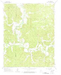
1963 Map of Gipsy
USGS Topo · Published 1973About this map
Castor River meanders through the heart of this landscape, its path defining the lowlands where the community of Gipsy and the settlement of Buchanan are situated. The 1963 survey shows a rural Ozark foothills environment where family life was anchored by local institutions like Cowan Ch and Pleasant Valley Ch. The mapping of several family burial grounds, including Maddox Cem and Clubb Cem, provides a detailed geographic record for genealogists researching the area's early residents.
Find a feature on this map
28 named features on this map. Tap any name to fly to it.
Don’t see what you’re looking for? This feature index may not catch every label — zoom into the map to look around manually.
Map Details
Editions of this 1963 Gipsy Map
2 editions found
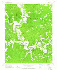
Other maps of this area

1930 · Coldwater
USGS Topo · 1:62,500

1933 · Marquand
USGS Topo · 1:62,500

1934 · Greenville
USGS Topo · 1:62,500

1935 · Zalma
USGS Topo · 1:62,500

1938 · Marquand
USGS Topo · 1:62,500

1939 · Greenville
USGS Topo · 1:62,500

1939 · Zalma
USGS Topo · 1:62,500

1949 · Rolla
USGS Topo · 1:250,000

1949 · Coldwater
USGS Topo · 1:62,500

1953 · Rolla
USGS Topo · 1:250,000