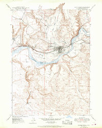
1948 Map of Glenns Ferry
USGS Topo · Published 1976About this map
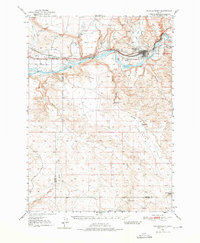
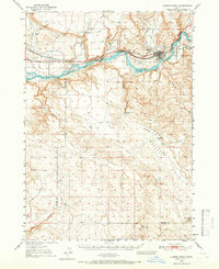
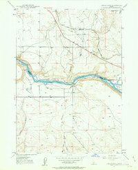
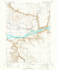
Three Island Crossing serves as a focal point on the Snake River in this mid-century survey, marking a legendary river crossing point along the historic Oregon Trail. The map documents the early infrastructure of Elmore and Owyhee Counties, where the Union Pacific Main Line follows the northern riverbank, paralleled by a network of early canals and siphons including the Bennett Canal. This irrigation system supported local agricultural interests like the McGinness Ranch, while remnants of earlier transport, such as Medbury Ferry (Aband), illustrate the transition from river ferries to rail dominance. The landscape is deeply incised by drainages such as Sailor Creek and Deadman Creek, which drop toward the river through rugged breaks. Significant landmarks for local history include the town of Glenns Ferry, the landing at Hammett, and several family-named wells and gulches that define the high desert plains.
Find a feature on this map
40 named features on this map. Tap any name to fly to it.
Don’t see what you’re looking for? This feature index may not catch every label — zoom into the map to look around manually.
Map Details
Editions of this 1948 Glenns Ferry Map
2 editions found
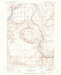
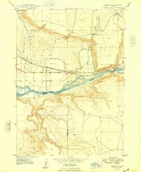
Other maps of this area

1892 · Mountain Home
USGS Topo · 1:125,000

1892 · Camas Prairie
USGS Topo · 1:125,000

1893 · Mountain Home
USGS Topo · 1:125,000

1893 · Camas Prairie
USGS Topo · 1:125,000
1947 · Indian Cove
USGS Topo · 1:24,000
1947 · Hammett
USGS Topo · 1:24,000
1947 · Glenns Ferry
USGS Topo · 1:24,000
1947 · Pasadena Valley
USGS Topo · 1:24,000

1948 · Pasadena Valley
USGS Topo · 1:24,000
1948 · Hammett
USGS Topo · 1:24,000