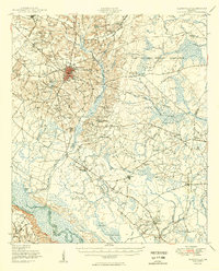
1950 Map of Glennville
USGS Topo · Published 1950About this map
Glennville stands as a central hub of settlement in this post-war survey, surrounded by a landscape of small family mills and country congregations. The southern reach of the quadrangle is dominated by the Altamaha River, where water features like Yankee Reach and Marrowbone Round mark the winding channel. To the east, the Camp Stewart Military Reservation occupies a significant portion of the terrain, its boundary cutting through former agricultural lands. Local life is documented through numerous rural landmarks, including the Dickey Powell Millpond and several schoolhouses like Rye Patch Sch and Ochs Grove School. The network of churches, such as Ebenezer Church and Pigot Branch Church, provides a clear view of the social geography of Tattnall and Long counties during this era of rural transition.
Find a feature on this map
63 named features on this map. Tap any name to fly to it.
Don’t see what you’re looking for? This feature index may not catch every label — zoom into the map to look around manually.
Map Details
Editions of this 1950 Glennville Map
2 editions found

Other maps of this area

1918 · Jesup
USGS Topo · 1:62,500

1918 · Hinesville
USGS Topo · 1:62,500

1919 · Claxton
USGS Topo · 1:62,500

1920 · Pembroke
USGS Topo · 1:62,500

1920 · Glennville
USGS Topo · 1:62,500

1943 · Ludowici
USGS Topo · 1:62,500

1943 · Jesup
USGS Topo · 1:62,500

1944 · Claxton
USGS Topo · 1:62,500

1944 · Glennville
USGS Topo · 1:62,500

1944 · Hinesville
USGS Topo · 1:62,500