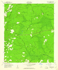
1958 Map of Glennville NE
USGS Topo · Published 1961About this map
Fort Stewart Military Reservation dominates this landscape, showing a period of transition as land was consolidated for military use during the late 1950s. The presence of numerous family and church burial sites, such as Poplar Head Cem, Oak Grove Cem, and Gaps of the Bays Cem, provides critical evidence of the rural communities and farmsteads that existed here before the reservation boundary was established.
Find a feature on this map
27 named features on this map. Tap any name to fly to it.
Don’t see what you’re looking for? This feature index may not catch every label — zoom into the map to look around manually.
Map Details
Editions of this 1958 Glennville NE Map
2 editions found
Other maps of this area

1918 · Hinesville
USGS Topo · 1:62,500

1919 · Claxton
USGS Topo · 1:62,500

1920 · Pembroke
USGS Topo · 1:62,500

1920 · Glennville
USGS Topo · 1:62,500

1944 · Claxton
USGS Topo · 1:62,500

1944 · Glennville
USGS Topo · 1:62,500

1944 · Hinesville
USGS Topo · 1:62,500

1946 · Brunswick
USGS Topo · 1:250,000

1947 · Savannah
USGS Topo · 1:250,000

1948 · Brunswick
USGS Topo · 1:250,000